
Welcome to PrivateBee
Revolutionizing Urban Air Navigation with Smart Technology
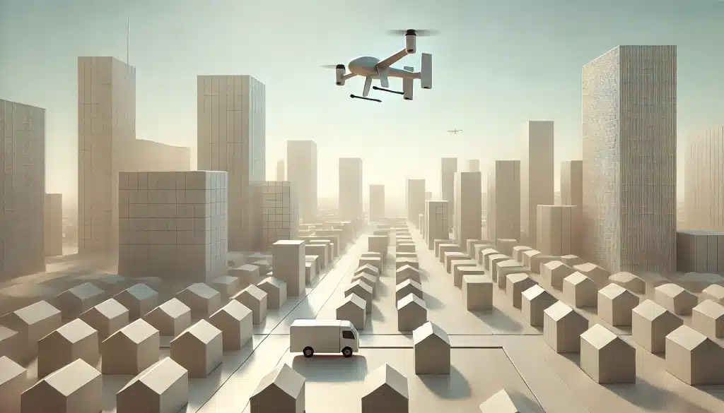
As urban environments evolve, so does the way we move through them — not only on the ground, but in the air. With the rapid rise of drones, air taxis, and next-generation aerial vehicles, the sky above our cities is becoming a new frontier for transportation. But with that opportunity comes complexity.
PrivateBee is a next-generation GPS navigation platform designed to meet the unique demands of urban air mobility. From drone pilots to professional operators of helicopters and emerging air vehicles, PrivateBee helps you fly smarter, safer, and with complete situational awareness.
Why PrivateBee?
Traditional GPS systems were never built with city skies in mind. Dense buildings, regulatory zones, restricted airspaces, and dynamic no-fly zones all create a new set of challenges for aerial navigation. PrivateBee was developed to solve exactly that.
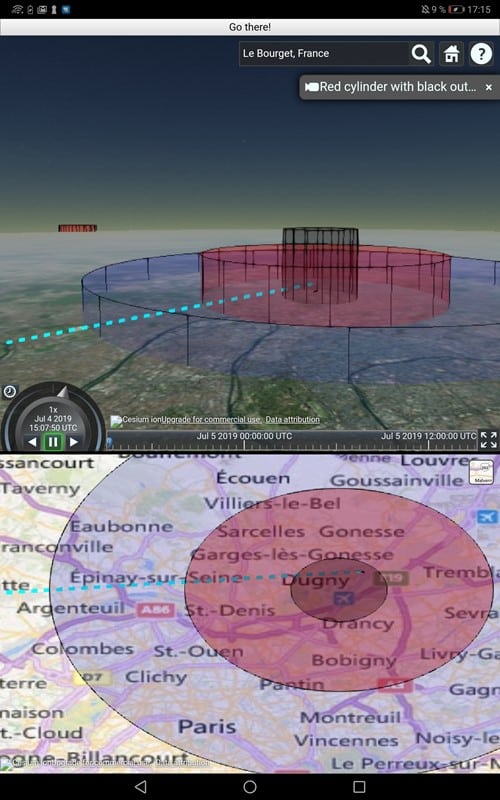
With PrivateBee, you’re not just reading a map — you’re interacting with a 3D representation of urban airspace in real time. Our system helps pilots visualize:
- Geofenced areas and no-fly zones
- Altitude restrictions and flight corridors
- Live position tracking with precision GPS
- Dynamic updates for airspace changes and alerts
- Intuitive touch interface for fast decision-making
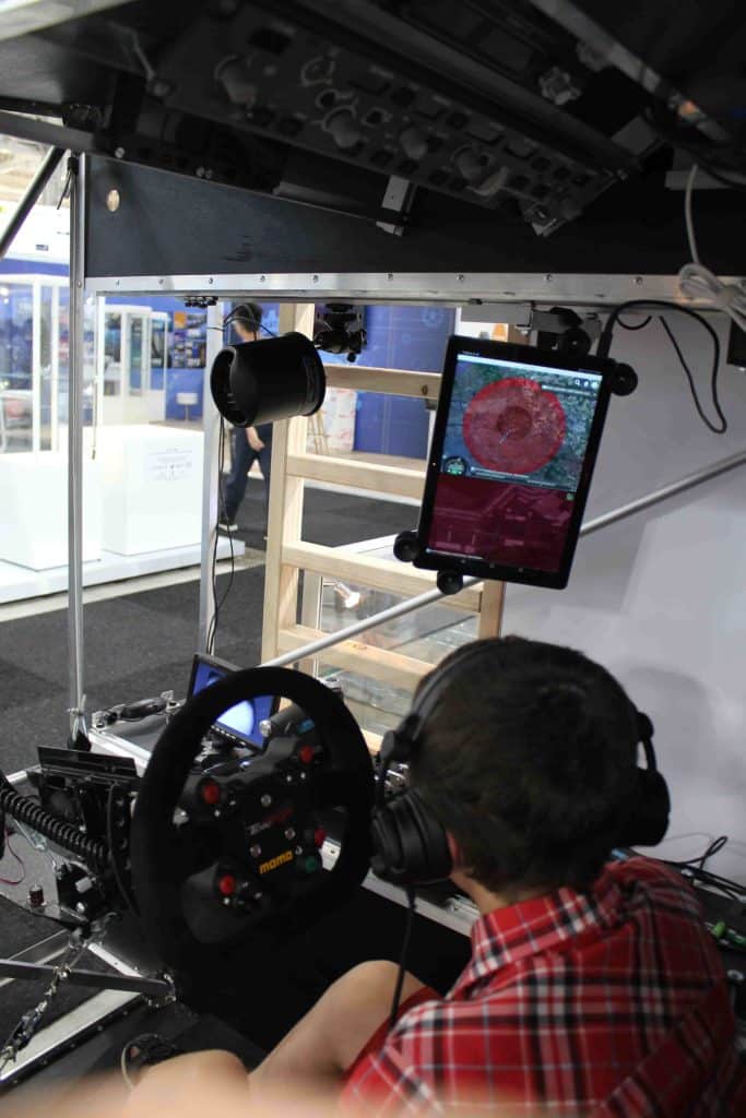
All this, directly on a tablet or cockpit display, with an interface built for clarity and speed.
Built for the Future of Flight
PrivateBee supports a wide range of use cases, including:
- Drone deliveries and inspections
- Urban air taxi routing
- Emergency and rescue operations
- Aerial surveying and media coverage
Whether you’re flying commercially or testing the next generation of personal air transport, PrivateBee adapts to your mission and helps you navigate with confidence.
More Than Just a Tool — It’s a Co-Pilot
We believe technology should empower, not complicate. That’s why PrivateBee was designed to be as powerful as it is user-friendly. It combines aerospace-grade data with an interface that anyone can learn quickly. You don’t have to be an expert pilot to benefit from smart airspace awareness — you just need PrivateBee by your side.
Join the Air Mobility Revolution
PrivateBee is currently in active development and testing, with pilot programs already underway in select cities. Our mission is to make air mobility safer, more efficient, and more accessible — one flight at a time.
Stay tuned for updates, launches, and partnership opportunities as we expand. The sky is no longer the limit — it’s the beginning.